

Mostrar el registro sencillo del ítem
Recuperación ecológica y embellecimiento paisajístico de áreas de importancia ambiental en el batallón de infantería N°15 general Francisco de Paula Santander Ocaña-Colombia.
| dc.contributor.advisor | Arévalo Bacca, Jhon Salvador | en_US |
| dc.contributor.author | Angarita Carvajalino, Kelly johanna | |
| dc.date.accessioned | 2025-01-22T20:00:24Z | |
| dc.date.available | 2025-01-22T20:00:24Z | |
| dc.date.issued | 2018-07-31 | |
| dc.identifier.uri | https://repositorioinstitucional.ufpso.edu.co/xmlui/handle/20.500.14167/4899 | |
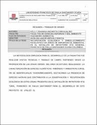
| dc.description.abstract | La metodología empleada para el desarrollo de la pasantía fue realizar visitas técnicas y trabajo de campo, partiendo desde la priorización de las zonas verdes del área de estudio, realizando la caracterización de especies florísticas arbóreas y arbustivas con el fin de identificarlas taxonómicamente, destacando la presencia de especies nativas que contribuyen a la conservación y recuperación ecológica de estas zonas presentes en el batallón de infantería n°15 "GRAL. Francisco de Paula Santander". para el desarrollo de este proyecto se utilizó el Software Arcgis 10.3 con la herramienta llamada SIG (sistema de información geográfico), para determinar y priorizar las zonas estratégicas. | en_US |
| dc.language.iso | spa | en_US |
| dc.subject | Desarrollo, visitas, zonas verdes, florísticas, arbóreas, arbustivas, taxonómicamente, conservación, ecológica. | en_US |
| dc.title | Recuperación ecológica y embellecimiento paisajístico de áreas de importancia ambiental en el batallón de infantería N°15 general Francisco de Paula Santander Ocaña-Colombia. | en_US |
| dc.title.translated | Ecological recovery and landscape beautification of areas of environmental importance in the 15th Infantry Battalion General Francisco de Paula Santander Ocaña-Colombia. | en_US |
| dc.description.abstractenglish | The methodology used for the development of the internship was to carry out technical visits and field work, starting from the prioritization of the green areas of the study area, carrying out the characterization of tree and shrub floristic species in order to identify them taxonomically, highlighting the presence of native species that contribute to the conservation and ecological recovery of these areas present in the 15th Infantry Battalion "GRAL. Francisco de Paula Santander". For the development of this project, Arcgis 10.3 Software was used with the tool called GIS (geographic information system), to determine and prioritize strategic areas. | en_US |
| dc.subject.keywords | Development, visits, green areas, floristic, arboreal, shrubby, taxonomically, conservation, ecological. | en_US |
| dc.identifier.instname | Universidad Francisco de Paula Santander Ocaña | en_US |
| dc.publisher.faculty | Facultad ciencias agrarias y del ambiente | en_US |
| dc.publisher.program | Pregrado ingeniería ambiental | en_US |
| dc.type.local | Pasantía | en_US |
| dc.description.degreelevel | Pregrado | en_US |
| dc.degree.name | Ingeniero ambiental | en_US |
| dc.contributor.jury | Amaya Amaya, Eimer | |
| dc.contributor.jury | Lozano Lázaro, Yeeny |
Ficheros en el ítem

Este ítem aparece en la(s) siguiente(s) colección(ones)
-
Pasantía [371]